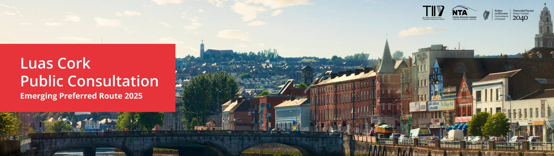
Luas Cork
Luas Cork is a proposed light rail line running from Ballincollig to Mahon Point, connecting key destinations such as MTU, Cork University Hospital, UCC, Cork city centre, Kent Station, Cork Docklands, Blackrock and Mahon.
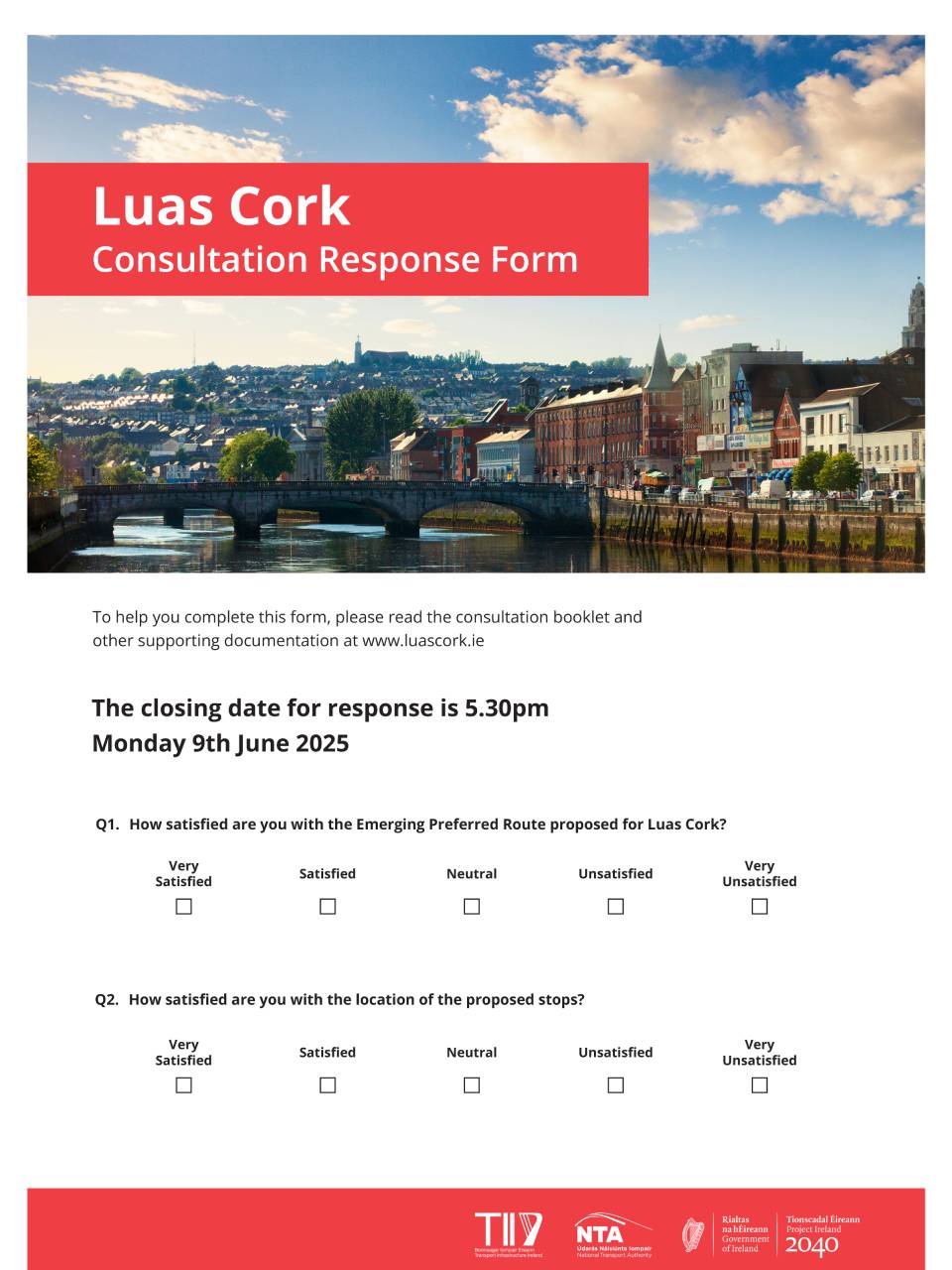
A non-statutory public consultation was held on the Emerging Preferred Route which closed on 9th June 2025. We are very grateful to everyone who made a submission. A report summarising the key findings is available here.
TII is committed to open and transparent consultation. In keeping with our policy you can read the submissions on the Luas Cork EPR here.
We will continue to engage with stakeholders as we develop the Preferred Route. We'll post updates on the next steps here.
Keep in touch via our email address info@luascork.ie
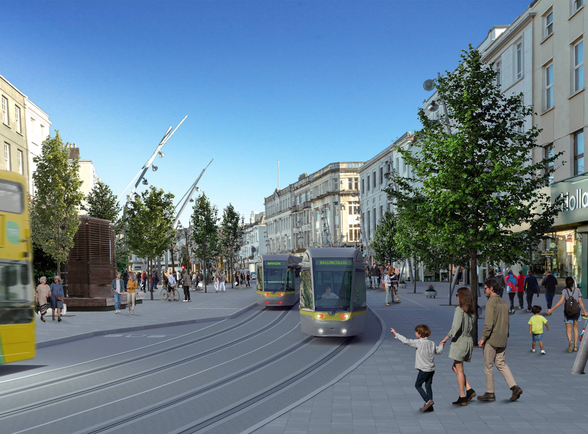
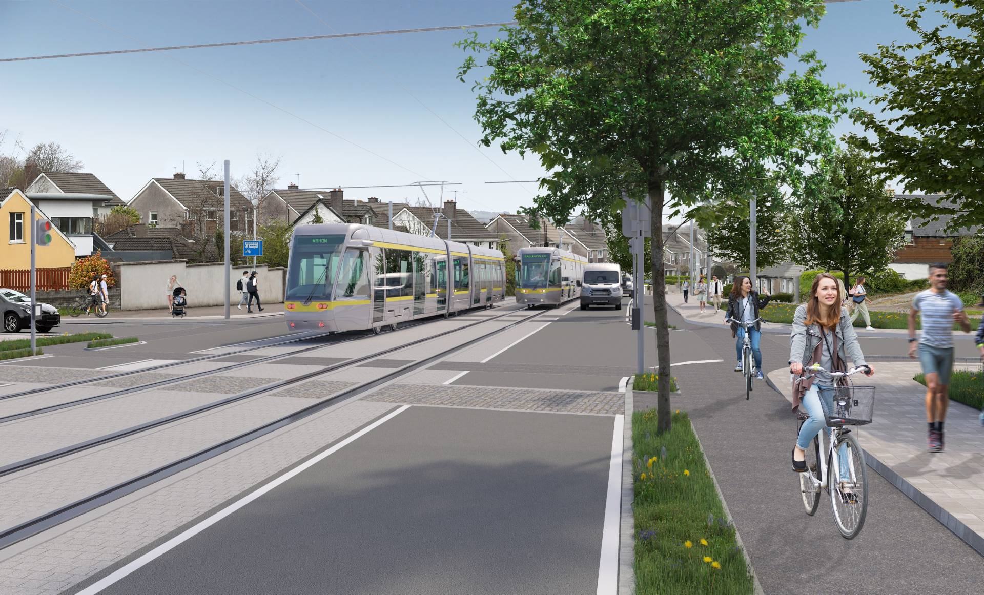
Indicative view of Luas Cork on St Patrick's Street
What is Luas Cork?
Luas Cork is a light rail line that will create a new public transport connection from Ballincollig to Mahon. It is a central part of the Cork Metropolitan Area Transport Strategy CMATS is planned to deliver a series of public transport services also including BusConnects Cork, heavy rail improvements, safe cycling and walking infrastructure.
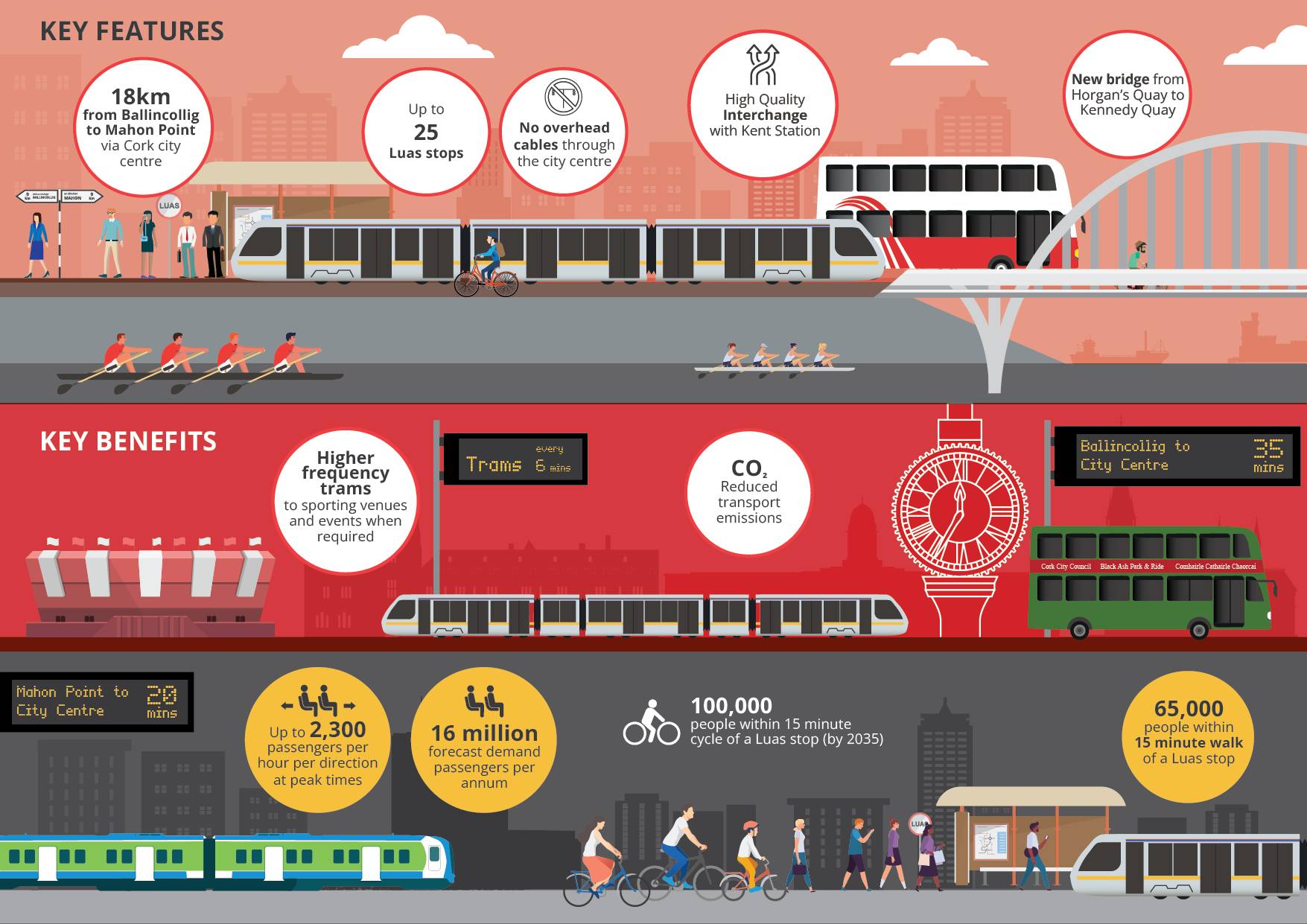
Luas Cork will include:
- Up to 25 Luas stops.
- Connection to Kent Station and other key destinations in Cork.
- Integrated active transport to support healthy, liveable and connected communities.
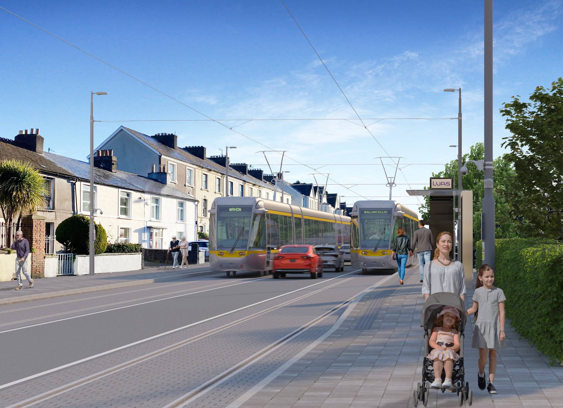
- Frequent services operating every six minutes.
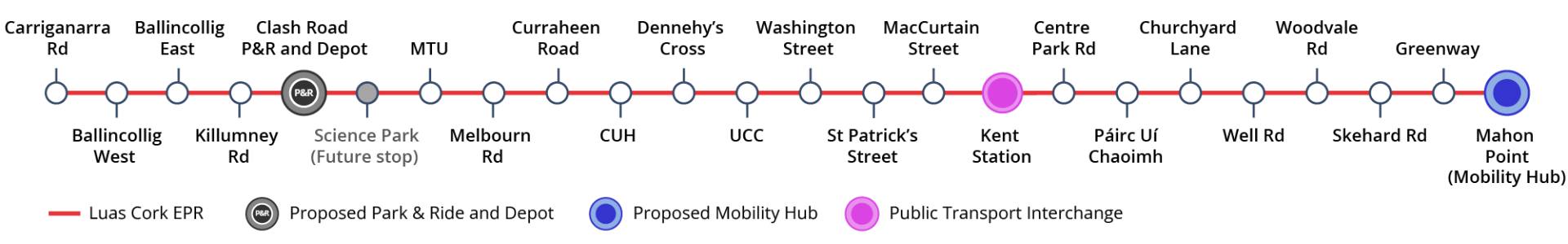
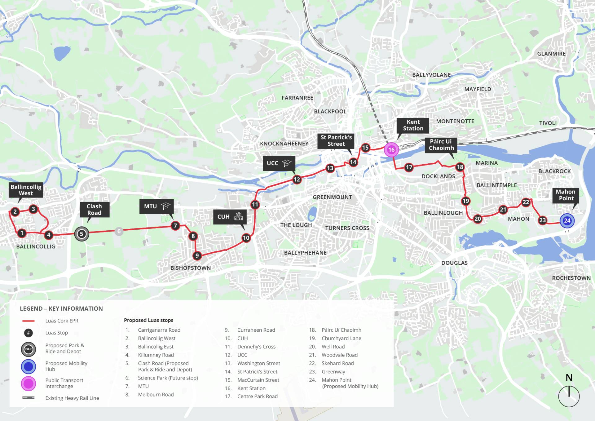
Emerging Preferred Route Map
Proposed route from Ballincollig to Mahon Point showing the 24 key stops and a new bridge over the Lee at Kent Station.
Luas Cork Key Benefits
Transforming the city
Cork will be the fastest-growing city in Ireland over the next 20 years with a population projected to grow by 50 to 60 percent. High-quality public transport projects like Luas Cork are key to delivering large-scale regeneration, such as the development of the Cork City Docklands, expected to deliver 20,000 new homes and almost 25,000 jobs across the 4.2-acre site at Kennedy Quay.
Safe and designed for all
TII puts “accessibility for all” at the core of its work.
Luas Cork will provide on-street lighting at stops, barrier and step-free infrastructure making travel easier for those with mobility issues, luggage or managing small children in buggies. The trams have lots of room for double strollers and wheelchairs as well as holding rails for children.
Reliable journey times
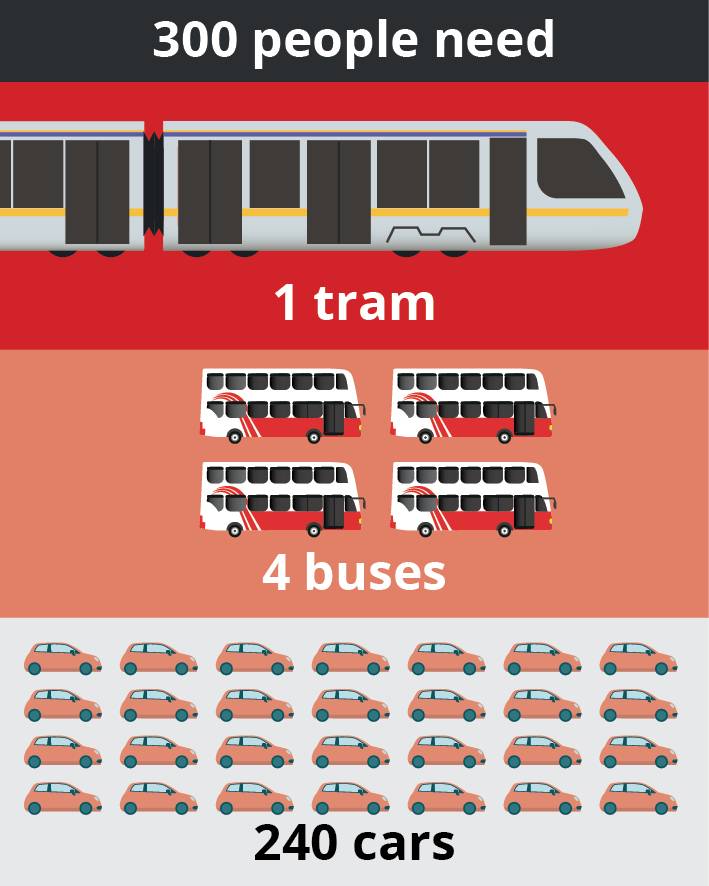
Luas Cork will offer more reliable journey times than other forms of travel. This will encourage people to leave their cars behind, easing congestion in areas like Wilton, Victoria Cross, Blackrock, and Mahon. The reduction of cars in the city centre will free up space for emergency vehicles and essential travel.
The Luas Cork EPR serves key third level institutions - UCC, MTU and the College of Commerce - enabling staff and students to reduce their dependency on cars and switch to public transport.
P&R and Mobility Hub
As part of the wider transport strategy for park and ride in Cork, we have identified potential sites at each end of the proposed Luas Cork route. A Park & Ride facility in Ballincollig including bike parking will enable commuters from the N22 to switch to Luas to complete their journey into Cork city.
A smaller Mobility Hub at Mahon would provide additional facilities such as bike parking, car sharing, links to local walking and cycling infrastructure and interchange with both Luas and buses.
Ireland’s first carbon neutral city
The European Commission has selected Cork to become one of Europe’s first climate neutral cities by 2030. Cork will be one of 100 cities to lead Europe in climate action. Transport emits 30pc of greenhouse gases in Ireland, so transforming transport is vital to make Cork a smart, carbon neutral city.
Landscape, Biodiversity and Urban Design
As Luas Cork develops from an Emerging Preferred Route to a detailed design, the public spaces, local landscapes, cycle routes, places and connections will all be developed and integrated into the scheme and follow design principles that respect landscape settings, enhance biodiversity and improve the public realm.
Integrated Travel
Luas Cork will create interchange opportunities with regional and Expressway/Intercity bus services from Cork City Bus Station at Parnell Place and heavy rail and Kent Station. The ongoing rollout of BusConnects Cork has also been considered alongside Luas Cork.
Active Travel
We will construct parallel cycle paths along sections of the rail line. Together with cycle parking, Luas Cork will integrate well with the existing and proposed Cork cycle network.
Emerging Preferred Route Description
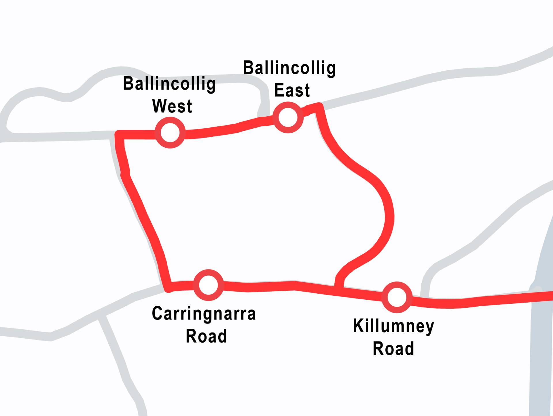
Ballincollig
The proposed route begins in Ballincollig with a single track loop beginning on Station Road.
At Station Road, the tram travels in a northbound direction on the single track, while one-way vehicular traffic travels southbound. On Ballincollig Main Street, the tram travels eastwards, one-way, on the single track through the village. Between Old Fort Road and the Station Road Junction cars will travel in a westerly direction only.
From the Old Fort Road junction with Main Street to the southern end of Leo Murphy Road, there are two lanes of traffic in each direction and a single southbound Luas track.
At the junction with Leo Murphy Road and Killumney Road, the tram reverts to a normal double-track arrangement eastwards towards the city centre while the single track arrangement returns westwards towards Station Road. Some land-take and car-parking removal will be required to deliver the scheme.
Single track loop around Ballincollig
Indicative view of Luas Cork through Main Street Ballincollig
Ballincollig to Wilton Road
From the Leo Murphy Road/Killumney Road junction, the EPR continues eastwards along Kilumney Road to the Kilumney Link East roundabout on the N22, which will be converted to a signalised junction. Then it proceeds east, running adjacent to the proposed depot and Park & Ride site.
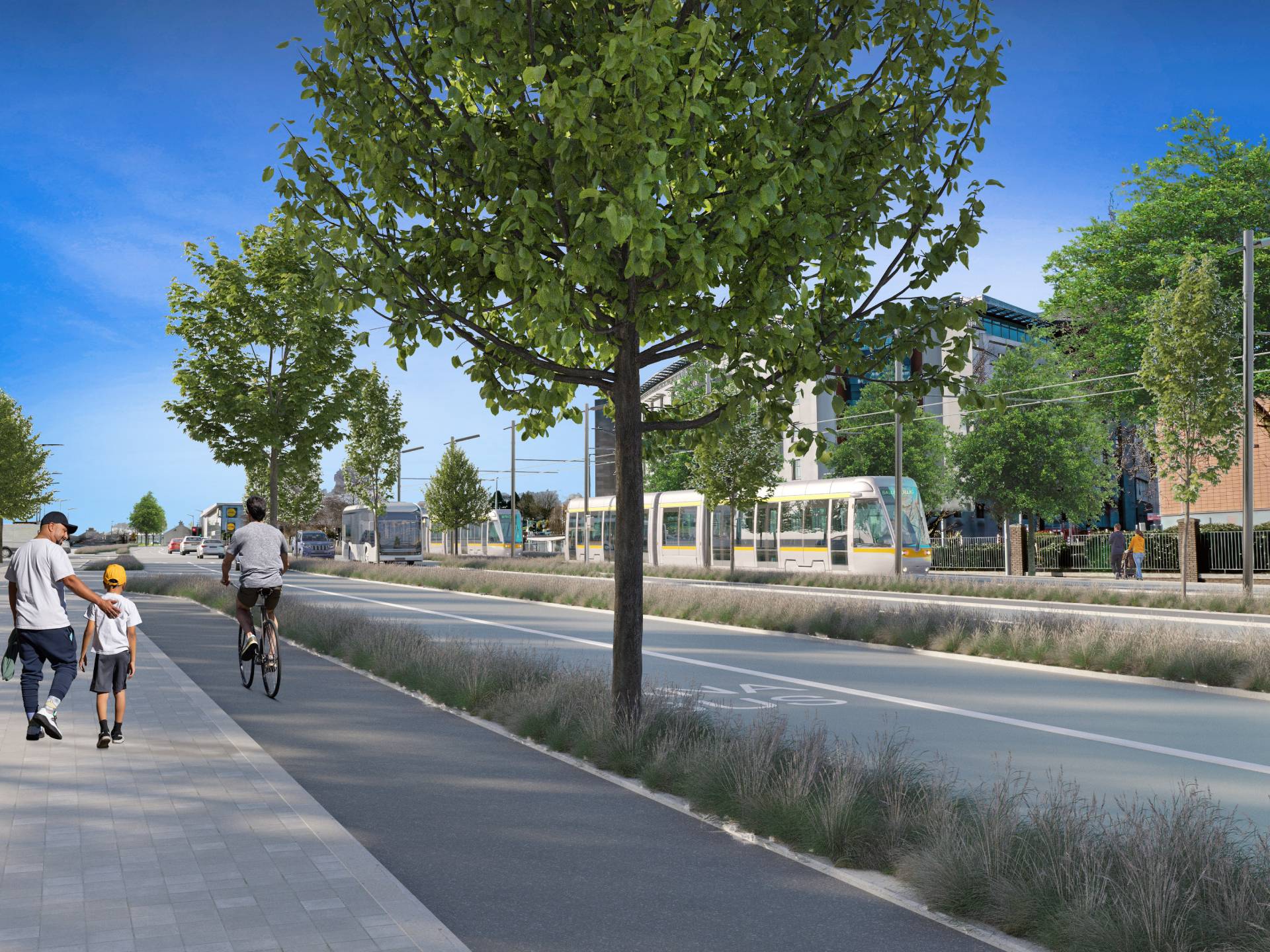
It then continues through agricultural land on a segregated and protected corridor for approximately 2.2km, until it reaches the Munster Technological University (MTU). A parallel, two-way cycle-path connects to the Curraheen Greenway and footpath at the Curraheen River end of the line.
Luas Cork enters the MTU grounds, crossing over the Curraheen River by bridge and running uphill between the existing GAA pitches and athletics track to a proposed stop in front of the campus administrative centre on Institute Road. The Institute Road/Rossa Avenue roundabout will be signalised.
The route then turns onto Melbourn Road. The inbound track will be shared with general traffic while the outbound track will be segregated for tram only. A northbound segregated traffic lane will also be provided on Melbourn Road.
The proposed layout aims to maintain the tree-lined suburban character of the area.
At the lower end of Melbourn Road, the line cuts diagonally through a green area towards Curraheen Road, to a proposed stop, positioned to protect the mature trees and planting as far as possible. Cycle lanes are included along Melbourn Road to maintain good connectivity to MTU.
From Melbourn Road, the route turns onto Curraheen Road where part of the alignment will be segregated for tram only, and part will be shared with general traffic and buses in both directions.
It is proposed to create new signal-controlled junctions with priority for Luas along the shared road sections. Along this section of the EPR some land-take will be necessary, mainly on the north side of Curraheen Road, to facilitate both BusConnects and Luas Cork. Where possible, the EPR for Luas Cork will use the corridor provided as part of BusConnects to provide priority for public transport while minimising the need for further road widening in the area.
From Curraheen Road the proposed route continues eastwards, joining Bishopstown Road and sharing with general traffic until Cork University Hospital/Wilton Shopping Centre. Here, the existing wide roadway enables segregation for all transport, including Luas, buses, general traffic, and cycle lanes. The EPR will be segregated along the hospital boundary and will turn northwards at the Wilton Roundabout.
A public transport interchange here will facilitate bus-to-Luas and Luas-to-bus transfers.
The Wilton roundabout is being upgraded to a signal-controlled junction for BusConnects, and some modifications will be required for Luas Cork afterwards.
Indicative view of Luas Cork through Bishopstown Road
Wilton Road to Cork City Centre
From the new Wilton junction the EPR travels along Wilton Road, through Dennehy’s Cross to Victoria Cross, where it turns east onto Western Road towards the city centre. On Wilton Road there will be a total of four lanes, as proposed for BusConnects Cork. The two central lanes will be allocated to general traffic and the two outer lanes to BusConnects/Luas. A new priority system at the signal-controlled junctions will ensure operational efficiency along this section of the corridor.
As the EPR proceeds through Victoria Cross and on to Western Road, it will continue to share the proposed BusConnects corridor. Four lanes will be provided: two central lanes for general traffic in each direction and two outside lanes for BusConnects/Luas. Some additional land-take is necessary along this section of the EPR, above what is required for BusConnects, primarily on the east side of Victoria Cross Road.
Indicative view of Luas Cork through Western Road
Along Western Road, the EPR will adopt a similar configuration to the proposed BusConnects scheme, including cycle lanes along Mardyke Walk.
On Western Road, from Victoria Cross to Gaol Walk, four lanes are provided for full bus and Luas segregation.
A three-lane configuration is proposed from Gaol Walk to the UCC entrance at the Donavan Road junction. From the UCC entrance, general traffic will be diverted north onto the Mardyke Road, while Luas Cork and BusConnects will proceed through a public transport gate onto Western Road along two-lanes running in each direction. Local traffic will be allowed to share the eastbound lane for access.
Segregated cycle routes through the city centre will be compatible with BusConnects and developed in conjunction with Cork City Council to ensure safety and permeability to and through the city for cyclists. They may run in parallel with the route or on adjacent but connected streets. In certain city centre areas, depending on further detailed analysis – a wire and pole-free Luas corridor is proposed.
This will minimise the impact on the public realm, will mean less clutter on the streets and make greening the city more achievable.
Luas Cork City Centre
As with other older European cities, crossing through the historic core of the city centre presents particular challenges. The tram needs to serve the heart of the city, whilst also minimising impact on sensitive building structures and integrating with the surrounding streetscape.
St Patrick’s Street to Kent Station
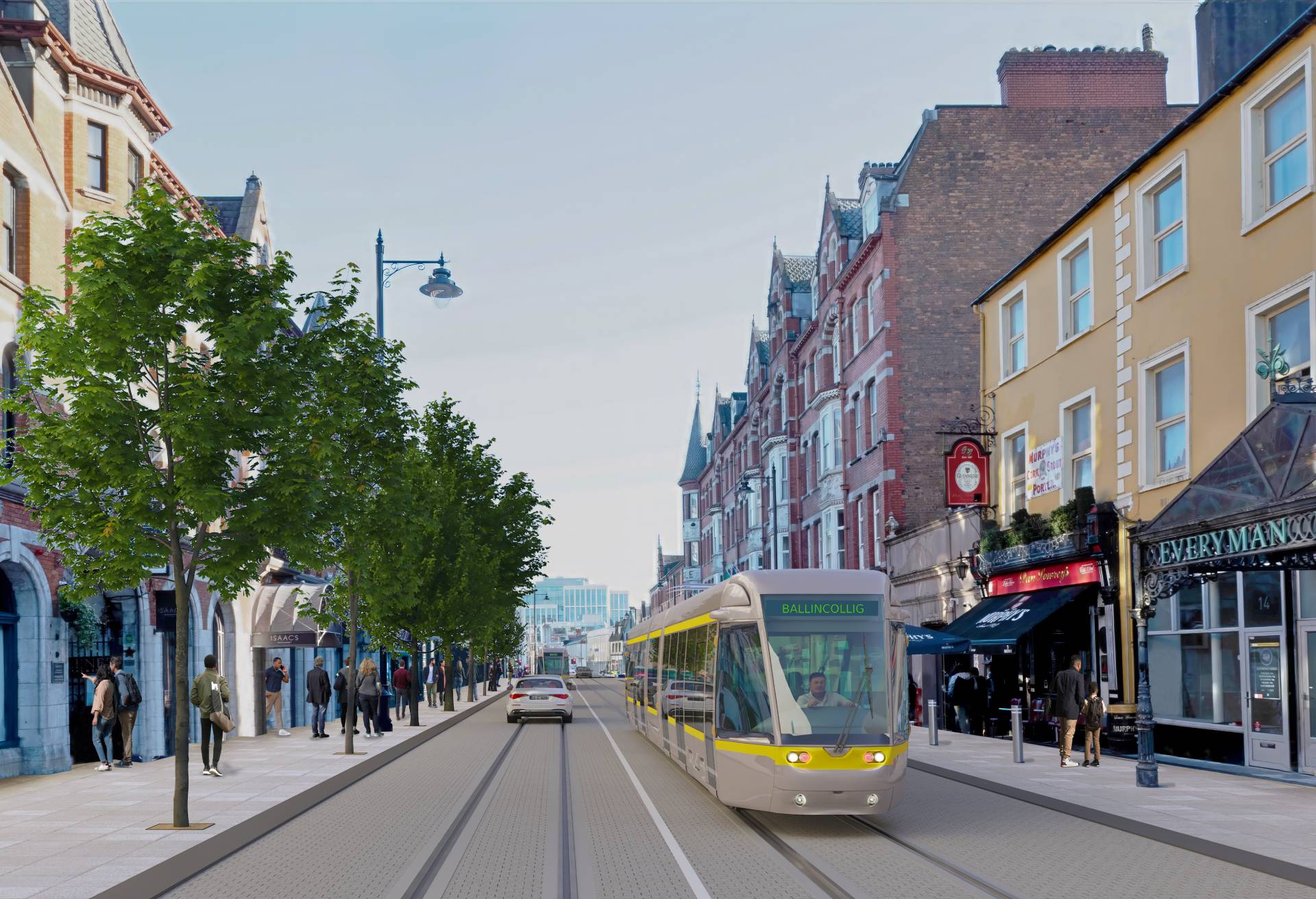
The proposed Emerging Preferred Route crosses the city centre via St Patrick’s Street, MacCurtain Street and Kent Station, with a tram stop at each of these locations. Picking up from Washington Street, the route turns left onto Grand Parade towards St Patrick’s Street. It is proposed that the corridor will be primarily public transport only as far as St Patrick’s Bridge, with some servicing of the street permissible.
Indicative view of Luas Cork through St Patrick’s Street
There are a series of tight curves around which the Luas vehicles must navigate, resulting in a couple of pinch-points at the corner of Washington Street/Grand Parade and at the junction of St Patrick’s Street/Grand Parade, with a possible impact on the corner building “Finn’s Corner”, subject to further detailed design.
As the design progresses, solutions will be developed to ensure an integrated and permeable cycle network for the city centre, while avoiding Washington Street/ Grand Parade and the junction of St Patrick’s Street.
Daunt’s Square will be pedestrianised, and vehicular access to Daunt’s Square/Paul Street from the south will no longer be permitted.
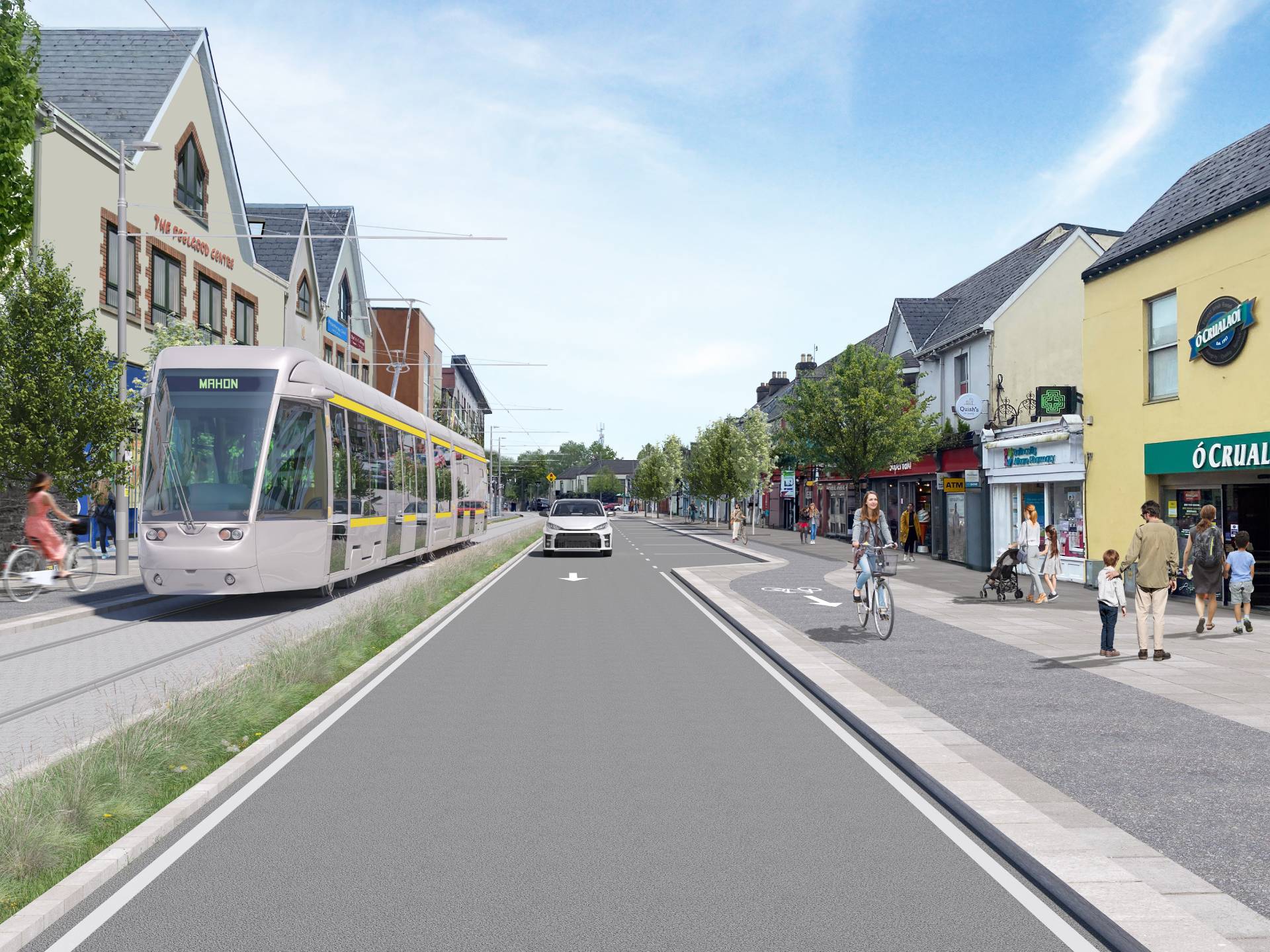
Once on St Patrick’s Street, the route continues eastwards, maintaining the wide footpaths and streetscape of this important public space in the heart of the city. Crossing St Patrick’s Bridge and onto MacCurtain Street, the route shares with buses and general traffic in an eastbound direction and with buses only in a westbound direction.
As with other streets along the route, St Patrick’s Street and MacCurtain Street will require works to accommodate the new Luas tracks including utility diversions and modifications to kerb lines and footpaths.
From the junction with Lower Glanmire Road, the route travels towards Kent Station via Alfred Street, sharing with buses in an eastbound direction. A Luas stop will be integrated into the proposed new entrance at the rear of Kent Station allowing easy transfer to commuter and inter-city rail services, buses, and other interchange facilities.
Indicative view of Luas Cork through MacCurtain Street
The EPR then travels southwards on a new public transport bridge over the River Lee from Horgan’s Quay to the south docklands at Furlong Street.
Kennedy Quay to Páirc Uí Chaoimh
Once across the new public transport bridge over the River Lee, the route continues southwards along Furlong Street before turning eastwards on to Centre Park Road, where the tracks will be fully segregated from other traffic. Some land-acquisition will be required at the Southern Milling site.
The EPR will be compatible with the South Docklands Area Based Transport Assessment and integrated with the future Docklands Development, creating an attractive streetscape for public transport, active travel, and access to the docklands and the Marina. The proposed configuration here includes a segregated Luas alignment on grass-track, a two-way road carriageway and bi-directional cycleways and footpaths. Through avenue management and careful landscaping, it is proposed to enhance the tree-lined avenue of Centre Park Road and the Marina setting.
Indicative view of Luas Cork through Páirc Uí Chaoimh
At the Centre Park Road/Marquee Road junction the EPR turns southwards before reaching Monahan Road, where the route runs along the southern boundary of the newly developed Marina Park.
Monahan Road will be partly realigned to the south to make space for the Luas corridor while limiting as far as possible impacts on the newly developed Marina Park and the mature trees in the area.
After crossing Monahan Road, the Luas corridor will pass to the south of the road, and at this location a Luas stop with a three-track configuration is proposed to serve the stadium and to facilitate possible service turnback towards the city centre at off-peak times.
The proposed three-track configuration will enable higher Luas capacity services when big events are taking place at Páirc Uí Chaoimh. Some land-take is required at this location to facilitate the proposed stop and the incline of the track alignment from Horgan’s Quay to the south docklands at Mill Road.
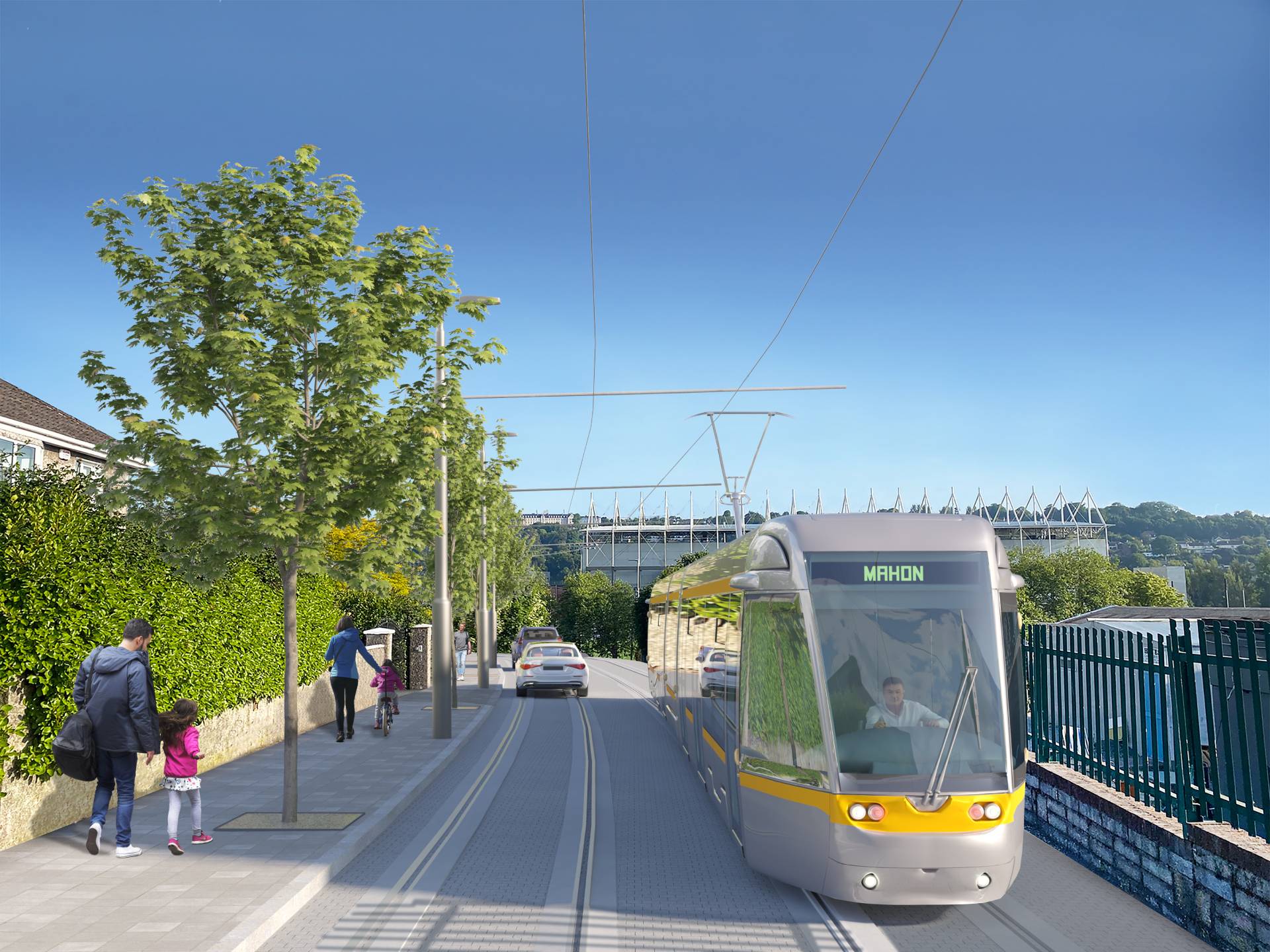
Páirc Uí Chaoimh to Mahon Point
From Páirc Uí Chaoimh, the EPR runs southbound on Maryville, up a steep hill to reach the junction with Blackrock Road, sharing with local access traffic only. Regrading works are necessary at the lower part of Maryville to enable Luas services to operate along this section of the route. The EPR then crosses Blackrock Road and on to Churchyard Lane where a portion of land-take will be required to facilitate the alignment. This includes the demolition of the Venue Bar, a well-known Ballintemple landmark. It is proposed to reinstate this corner site as part of the works, in keeping with the Architectural Conservation Area (ACA) status of the village.
The EPR continues southbound on Churchyard Lane sharing with general traffic, which will be permitted for local access only, until the Churchyard Lane/ Boreenmanna Road junction. Existing on-street parking on Churchyard Lane will be relocated - some on Churchyard Lane itself and some to the rear of Churchyard Lane, at the entrance to Ashcroft Estate.
From the Boreenmanna Road junction, the wider road offers the opportunity to partially segregate the EPR whilst maintaining a northbound-lane for general traffic and the provision of segregated cycling and pedestrian infrastructure. The boundary to the quarry may be impacted at this location and careful consideration will be given to landscape reinstatement and to the restoration of the quarry’s natural setting.
At the southern end of Churchyard Lane, the EPR turns eastwards on to Skehard Road. The proposed BusConnects Sustainable Transport Corridor (STC) J proposes a four-lane configuration on Skehard Road until such time.
There are small sections of land-take required to implement the proposed scheme successfully, towards the eastern end of Skehard Road. At the Blackrock Avenue junction, the EPR leaves Skehard Road and turns southbound on to Mahon Link Road, where the alignment will run on segregated track on the west side of the road, parallel to the existing Greenway. The existing tree-lined kerb on the western side of Mahon Link Road will be maintained.
A two-lane configuration will be adopted to the east side of the EPR for general traffic, which will result in some land-take and replanting along the eastern property boundaries.
Indicative view of Luas Cork through Skehard Road
The EPR will continue southbound following the road alignment to the proposed terminus northeast of the Mahon Link Road/City Gate junction. Segregated cycling and pedestrian facilities will be provided along Mahon Link Road and will lead to the terminus where a proposed potential Mobility Hub would promote and enhance transport interchange opportunities between private car, public transport, and active travel users.
The Mahon Link Road/City Gate junction will also be upgraded as part of the BusConnects proposals, providing enhanced pedestrian and cycling facilities and better connectivity to Mahon Point Shopping Centre.
Next Steps
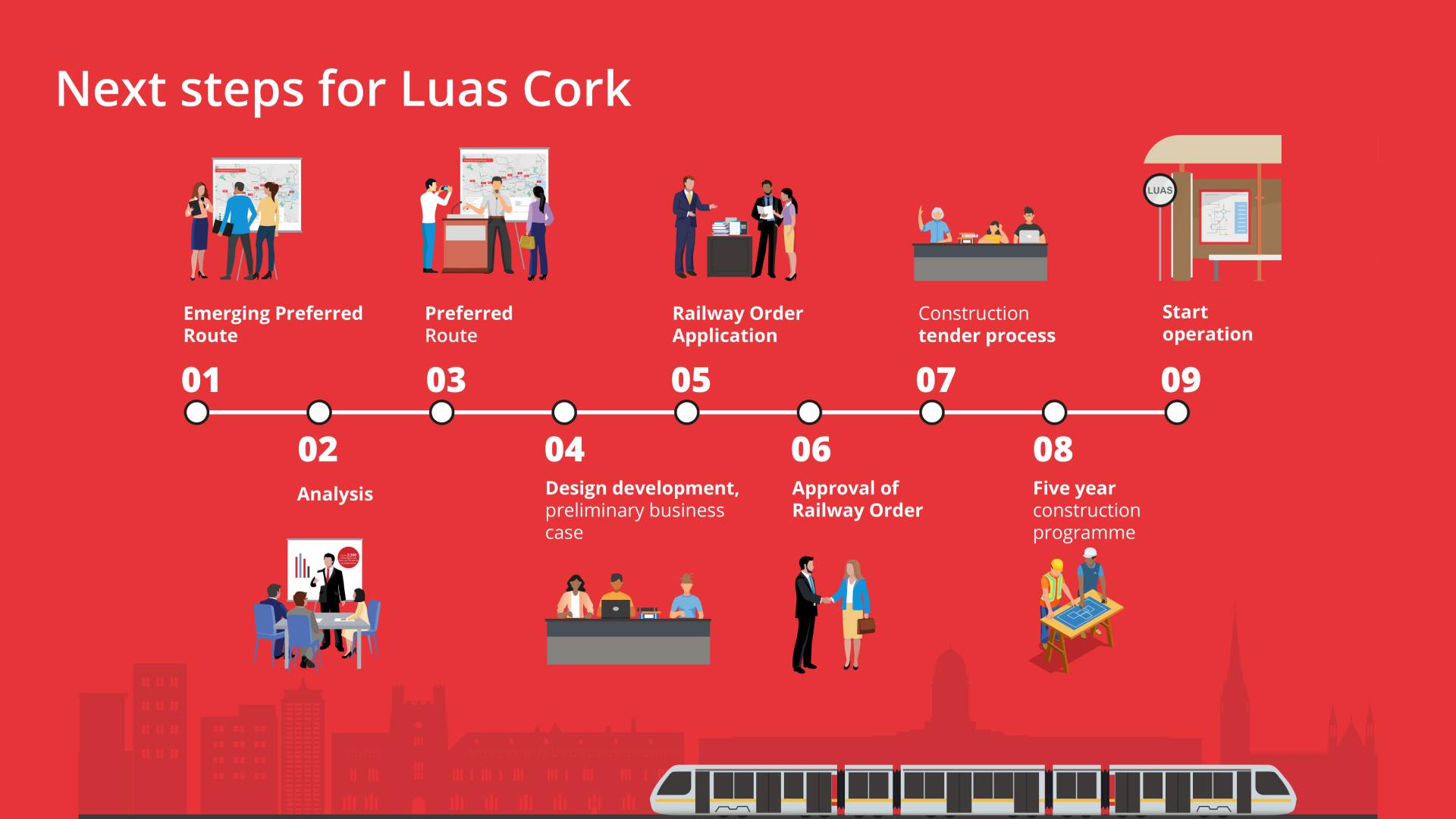
Have Your Say
We are committed to a meaningful and ongoing process of consultation and engagement with everyone affected by this proposal.
We are currently reviewing the submissions made during the EPR consultation and will be publishing a report in due course. Updates will be posted here and we will continue to engage with key stakeholders as the design is refined.
Downloads


Contact
By Post Luas Cork, Transport Infrastructure Ireland, PO Box 13605, Little Island, Cork
Email info@luascork.ie
Phone 1800 777 321
Our phone line is open 24 hours a day. If you leave a message, we'll aim to return your call between 9:30am and 5pm the next working day.